Location of the development?
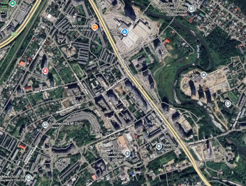
The Shishimskaya Gorka project is located in the Uktus area of Yekaterinburg, Sverdlovsk Oblast, Russia, within the Chkalovsky District, approximately 7.4 km from the city centre. The site is well served by public transport, with trolleybus routes running along all sides except the west, which is served instead by a tram line.
The development spans approximately 25 hectares and is bordered by Shcherbakova, Gastello, Dalnevostochnaya, and Mramorskaya Streets. It occupies a unique position between the existing urban fabric and the scenic Uktus Mountains, with the forested Uktus Forest Park lying directly to the west.
Prior to development, the site was a former industrial area — home to an iron factory and old wooden housing. This housing was later destroyed by fire, a consequence of its timber construction, and was subsequently rebuilt. The terrain itself is harsh and uneven, with elevation changes reaching up to 40 metres. This challenging topography discouraged investment from the public, private, and government sectors alike, and for years it also cut the surrounding area off from the wider city, limiting connectivity and access to public space. See figure 1 google map
The main idea behind the Shishimskaya Gorka urban development, the cause for the development?
Shishimskaya Gorka was selected for redevelopment because the wider Uktus area was already undergoing urban transformation, while the site itself combined older housing, garages, industrial uses, and difficult terrain. The approved planning framework identified the broader Shishimskaya Gorka territory for major reconstruction, encompassing new housing, streets, public spaces, parks, and supporting infrastructure.
Several factors drove the redevelopment. A key aim was to restore the “once-lost urban connection with the river” and create an attractive cityscape as seen from the water’s edge. A specific historical rationale also shaped the park feature: a pedestrian route to the Uktus Mountains once ran through the site, and the design team chose to restore it while preserving the natural hilly relief. Another driving factor was the rehousing of residents from unfit, substandard housing, which freed the site for construction — effectively a slum-clearance program that enabled the wider transformation. More broadly, the development is driven by a deliberate intent to retain the site’s historic town-planning grain and green character, while introducing a new, diverse, and affordable mixed-use housing typology — a contrast to the Soviet-era redevelopments that erased this fine grain elsewhere in the city. A further guiding concept was to create nature-integrated public spaces open to all city residents, blending the new mixed-use quarter seamlessly into the existing landscape.
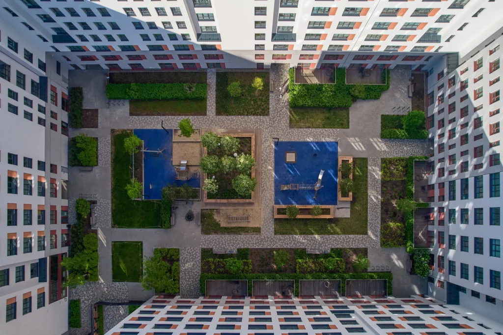
Shishimskaya Gorka is planned as a predominantly residential, mixed-use neighbourhood covering approximately 25 hectares, with around 300,000 m² of residential floor area. The development comprises several residential quarters of varying building heights. The completed phases feature semi-enclosed blocks, generally ranging from 6–9 storeys along secondary streets to 10–25 storeys along the principal urban routes. Underground parking keeps the internal courtyards free of cars. See figure 2 , the master plan

A detailed Analysis of the development stating from the external form to the site plan, plans of the development, and its architectural, urban design or planning theme
The central urban-design idea behind Shishimskaya Gorka was to connect its various residential components through a continuous system of public spaces, rather than treating each block as an isolated development. The concept deliberately retained the historic town-planning grain established during the Soviet era, when the area’s buildings followed a “chessboard” layout. The urban designers preserved this same underlying pattern but layered onto it a new emphasis on linking the spaces between buildings — ensuring every block enjoys open views, whether onto a courtyard or outward to the surrounding landscape, with a high degree of permeability throughout. See figure 3, development external building view of the design
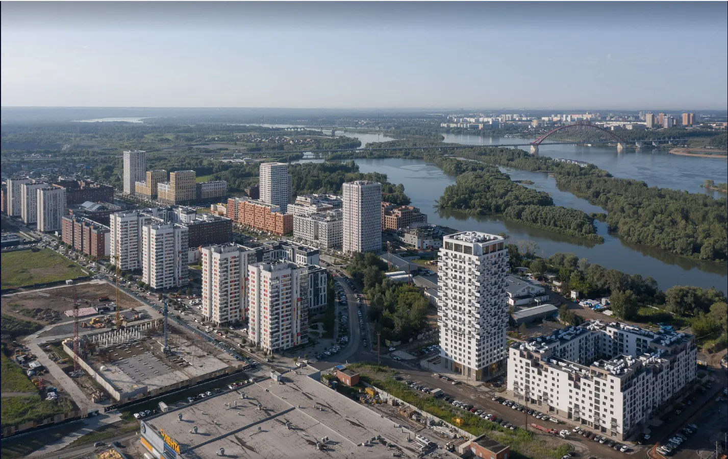
The buildings are deliberately staggered, offset from that opposite, so that the resulting open spaces themselves become a dynamic, flowing feature of movement through the site rather than a static void. A hierarchy of building heights was also introduced, rising toward the rear of the development and stepping down toward the river to preserve view corridors. Each block is given its own quiet courtyard, set back from the busier public spaces and linked to the others — intended primarily for residents’ children to use. One aspect the site has not recovered, however, is the historic connection between the urban development and the river, which earlier phases of the area once maintained. See figure 3 internal courtyard of the buildings
The design also responds directly to Yekaterinburg’s severe continental climate. Planting was selected to withstand temperatures ranging from approximately −40°C to +40°C, while evergreen and winter-tolerant species maintain landscape interest through the cold months. To protect against the harsh winter conditions, planting is set within raised concrete beds.
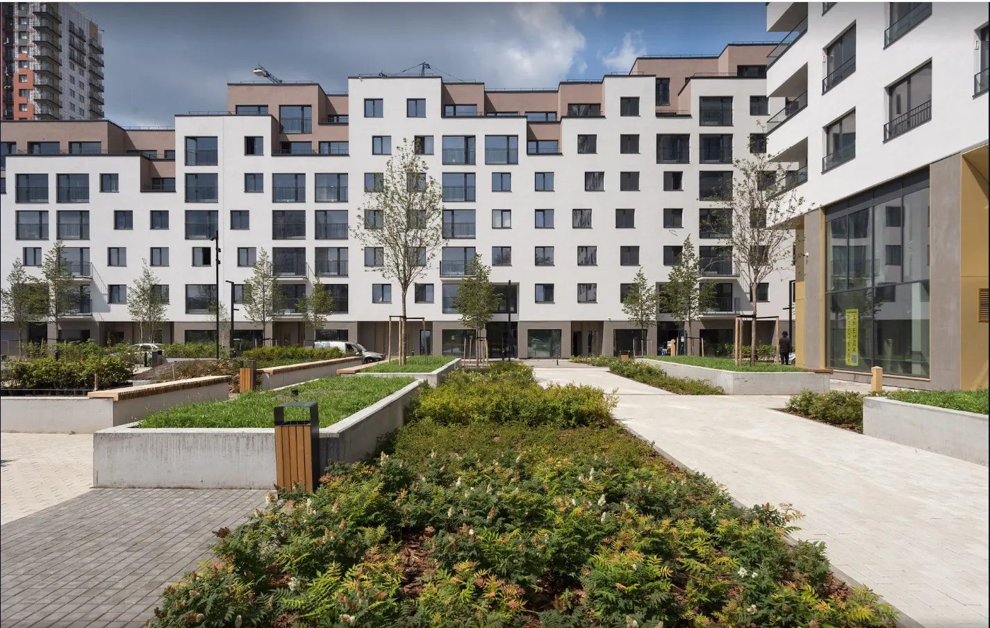
The architecture itself draws on a Northern European design approach. Building masses are composed of recesses and projections to create varied silhouettes and to break up what would otherwise be rigid, monolithic forms. The architects favored a human scale throughout, with minimalist façades and natural colours and materials. Two consistent threads tie the different blocks and towers together visually: a shared stucco treatment and colour palette across all buildings, and the use of brown accent elements — composite panels on the lower blocks and fibre cement boards on the tower buildings. The façades are further designed to avoid a single repetitive window rhythm, instead varying window scale across the elevations. See figure 4 , external building forms
Detailed analysis of the development plans
The floor plans vary considerably in layout and area, reflecting a mix of flat sizes across the development. As a general principle, the architects oriented all living spaces toward the river view, with each unit given either a terrace or a balcony facing that outlook. The buildings closest to the river reach 6–9 storeys, while the towers set further back rise to 25 storeys.
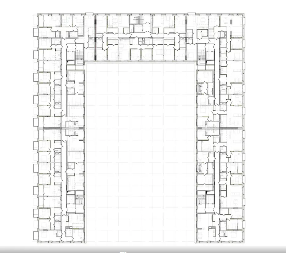
The buildings at the centre of the development follow a zoned functional layout. The U-shaped blocks are organised into five zones, arranged around a central core containing vertical circulation, with corridors leading off to the individual flats. See figure 5, the plan of the 5th floor
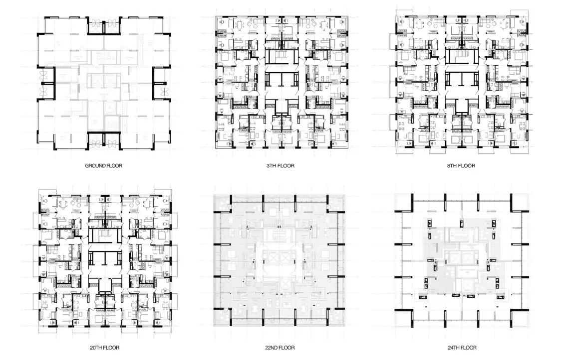
In the tower buildings, the same principle applies at a simpler scale: a central core houses vertical circulation, surrounded by corridors that lead to the flats. See figure 6, the tower plan with the central core and surrounding flats.
The landscape theme and design
The material palette for the public realm combines metal, larch timber, grass, sand, decking, and paving slabs. Rather than relying solely on conventional hard paving, the project team used a variety of surfaces to define distinct zones for movement, play, recreation, and landscape within the pedestrian corridor. Street furniture and play structures are built from metal and larch, while changes in paving pattern help distinguish one area from another. See figure 7, the external landscape layout.
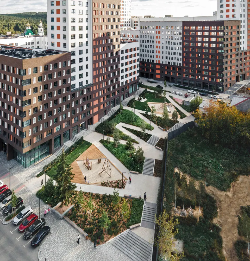
The landscape approach also responds closely to the local environment. Planting was selected to suit the Ural climate, with trees, shrubs, and perennials capable of tolerating temperatures down to approximately −40°C. Local character was reinforced through the use of native species such as spruce, birch, pine, rowan, and linden, while existing vegetation — including a spruce estimated at 30–40 years old — was retained on site.
Safety and accessibility were key considerations in surface and material selection, since the public realm needed to accommodate pedestrians, cyclists, children, parents with prams, and wheelchair users. The principal pedestrian route maintains a maximum gradient of approximately 3%, while the combination of paving, decking, grass, and sand helps create clearly differentiated areas throughout the landscape. See figure 8 Building courtyard landscape area